Ships Log kept by Captain Angus.
Star Date: Have no idea. What stars? It’s raining. Have searched for amazing views and astonishing scenery in Madagascar. This doesn’t look like Madagascar. The charts given to me by hose chuckling penguins seem wrong. I did wonder if a chart scrawled with crayon would be reliable.
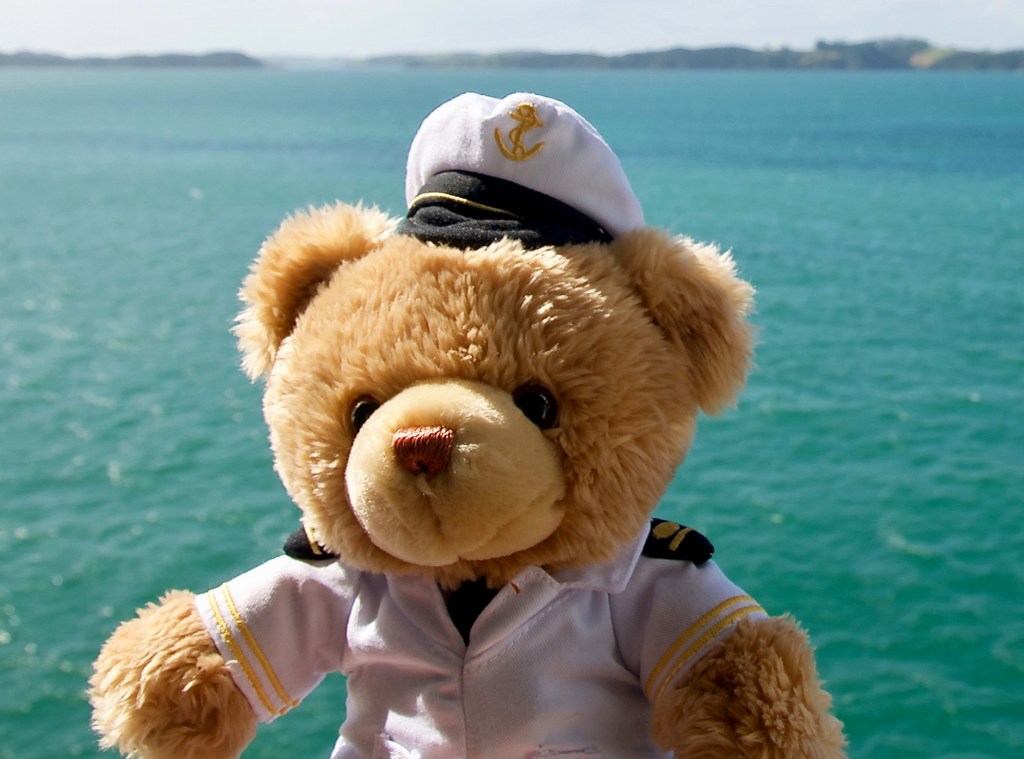
Ships Log: Star Date – Later than before. Still no stars. I have bravely steered where no bear has ever gone before. And it’s still raining. My hat is soggy. My beautiful captain’s hat. It’s soggy, I tell you. Bother those penguins! What’s that ahead? I can see something. Land ho!

Ships Log kept by Captain Angus.
Stardate: Still don’t know. Have reached Doubtful Sound. Possibly. Doubtful about it. Hard to see. Could be any old Sound. None of the pictures I ever saw of Madagascar looked like this. Where are the lemurs? Are we lost? Still raining. Forecast is for more rain. Oh look, another Sound up ahead. I’m tired. It isn’t easy being a small bear steering a big ship. I want to dry my hat. I need coffee.
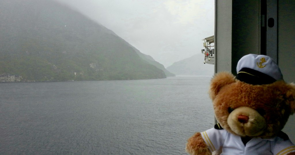
Captain Angus Ships Log: Star date- still no idea. It’s been raining. Have steered away from Doubtful Sound. If it was Doubtful. Have my doubts. We are now seeking new mountains and drenched forests in Madagascar. Forecast is for more rain. Of course, it is.
LATER: HB Bear writing in Ships’s Log
Stardate: .. What? What the great sleeping bears is a ‘star date’? Today is today, of course. Captain Angus has gone below to wring out his soggy hat. Muttered something about, “Penguins, you just can’t trust them”. And, “Coffee, give me coffee”. The ship is now safely in my paws. Umm, How do you steer this thing? Who drew this chart? Oh look, green crayon and orange crayon and red crayon. Those are my favorites too. I wonder what it shows?
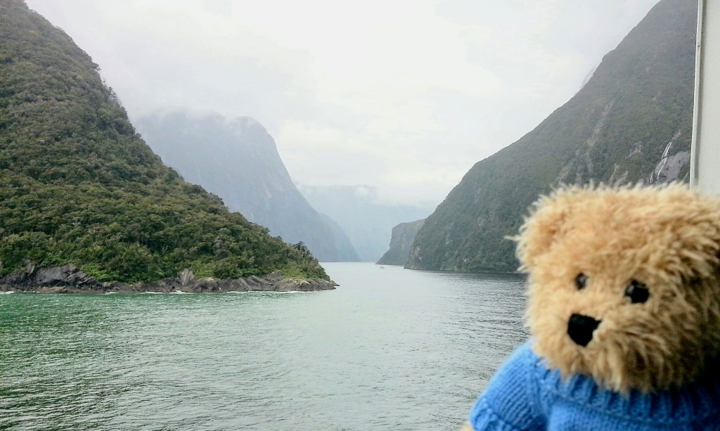
HB Bear writing in Ships Log.
Not raining so much. Starting to enjoy this. I’ve steered this way and steered that way and not hit anything yet. Maybe if I steer all the way through this wiggly gap in the mountains, we will come out on the other side at Madagascar.
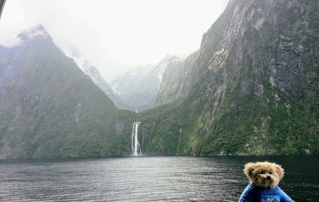
HB Bear writing in Ships Log.
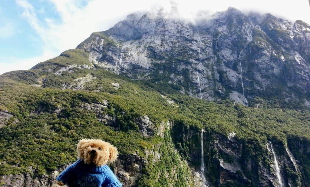
Just look at all these waterfalls. Wow, I love this place. Found a new chart. It is not scrawled in crayon. The proper chart says ‘Milford Sound’ and ‘New Zealand’. I wonder if Captain Angus will return to the helm? I wonder if Angus will bring me coffee? I wonder if Madagascar is close to New Zealand.
HB Bear writing in Ships Log.
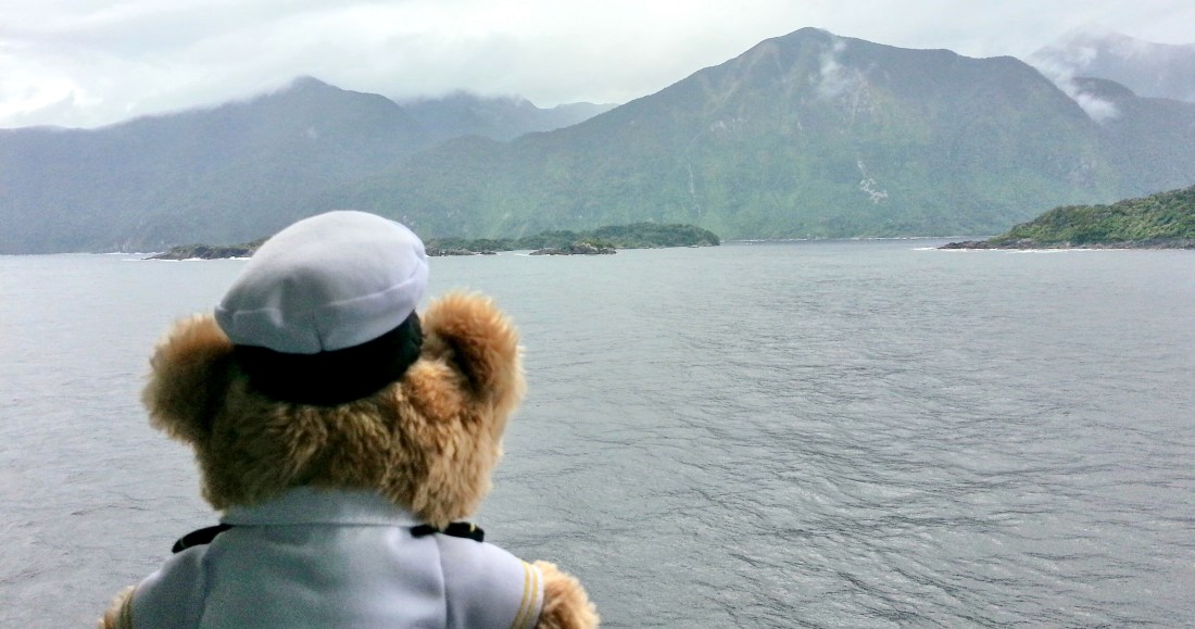
I love steering this big ship. The rain is clearing! Oh look, mountains and waterfalls everywhere. I will just take my paws off the helm and run over to the rail to take a selfie. Oh yes! That’s me. Do you see me in my picture?. But wait … the land is getting closer. It’s getting closer fast. The land is coming straight for us really, really fast. Oh no! we’re running aground!
GRIND SCRAP GRRRRRRIIIIIINNNDDDD SCRRRRRRRRRAAAPPP BANGGG.
HB Bear: Oops. Perhaps I ought not to have taken selfies while driving. Angus will not be happy with me. Oh dear. If only we had run aground on Madagascar.
What next: Will our small bears salvage the big ship from the fiords? Will they ever find Madagascar? Why did they ever listen to those penguins?

You are at Mark’s blog called Baffled Bear Books. Mark is a dark coffee tragic, bibliophile and Guardian of Mawson Bear, a Ponderer of Baffling Things and one of this bright world’s few published bears.